
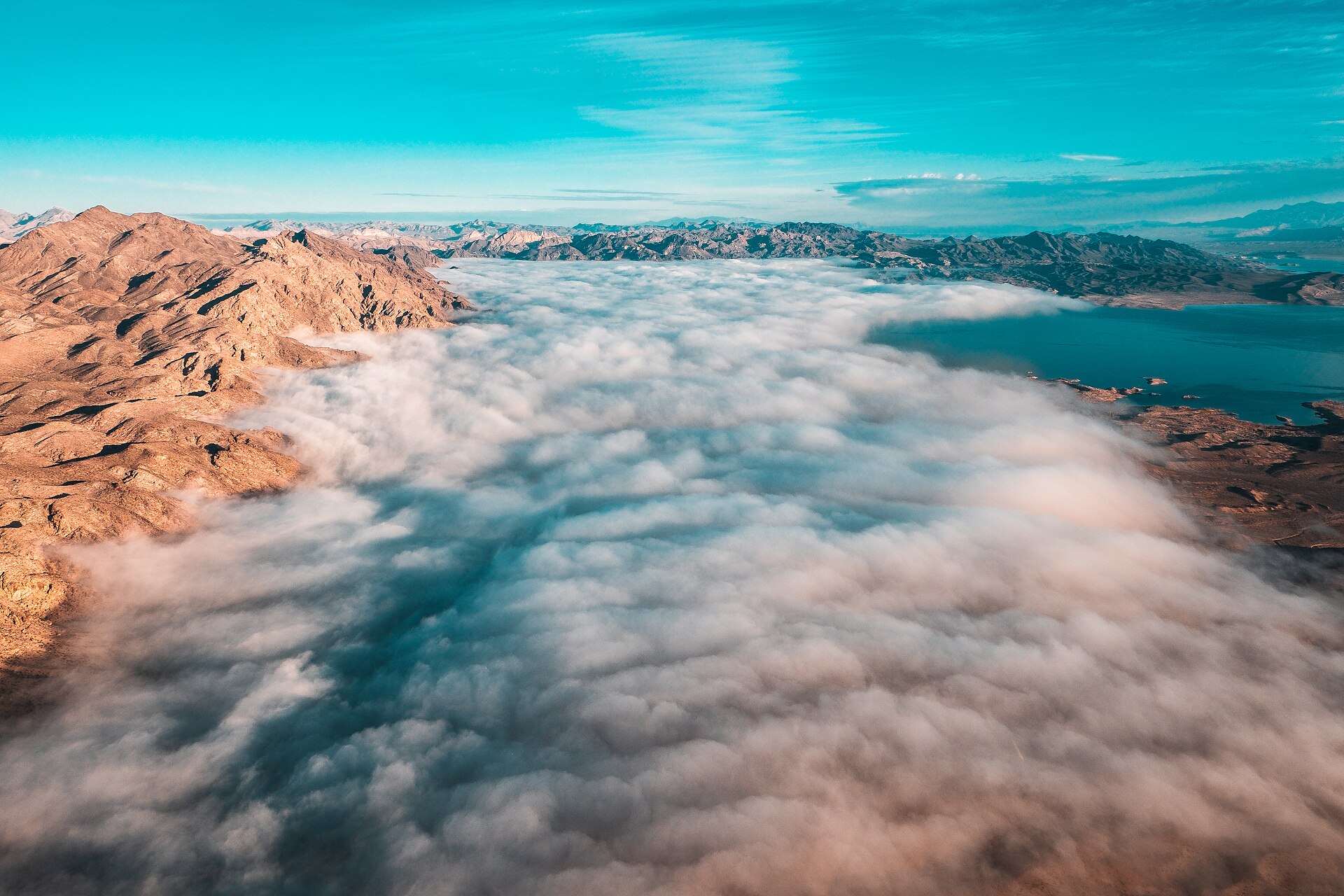
The country’s largest reservoir has slipped below its previous low after a brief recovery. The new mark raises the pressure on Western states, tribes and water users already negotiating how to live with less Colorado River water.
Lake Mead reached its lowest water level on record, falling to an elevation of 1,040.5 feet on Aug. 7, 2026. The reservoir outside Las Vegas has now passed its previous modern low, a grim milestone amid a growing water crisis across the drought-stricken West.
Lake Mead hits record-low territory at a moment when the Colorado River’s seven basin states are still confronting a basic problem: the system does not reliably supply enough water to meet its long-standing demands. The number matters because Mead supports drinking-water deliveries, farming, hydropower and a regional economy built around a river under mounting strain.
A new low after recovery
Lake Mead’s elevation had declined every day since July 31, according to Bureau of Reclamation data cited by USA Today. Officials have tracked elevations since the reservoir began filling in the 1930s following the construction of Hoover Dam.
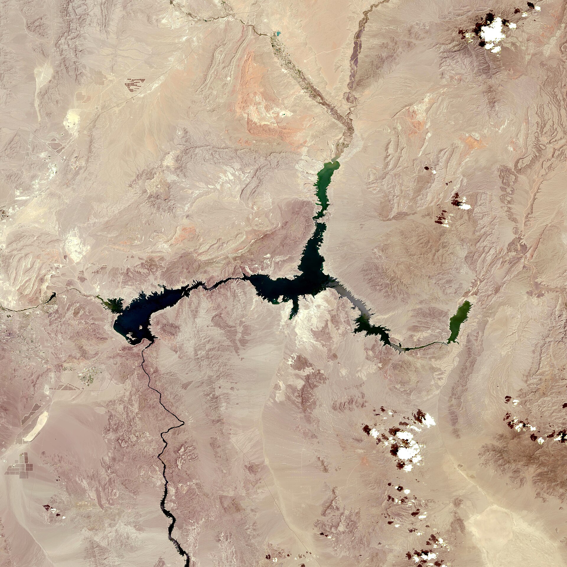
The previous modern low was 1,040.58 feet, recorded on July 28, 2022. Several wetter winters subsequently helped lift the reservoir, offering a reprieve but not a lasting reset for the Colorado River system.
That narrow difference between the old mark and the new one should not obscure the bigger story. Lake levels can respond to a season of runoff, releases and conservation, but the longer-term imbalance between available water and demand remains unresolved.
Brad Udall, a senior climate scientist at Colorado State University’s Colorado Water Center, described the latest mark as grim and said action is needed quickly. His concern is not just the lake’s surface elevation; it is what a continued decline could mean for the systems built around it.
Why one reservoir affects millions
Lake Mead is the largest reservoir in the United States and a critical storage point on the Colorado River. It is a source of drinking water for roughly 25 million people, including the Las Vegas metropolitan area, within a basin that serves about 40 million people overall.
The river also supports irrigation for about 5 million acres of farmland. That includes California agriculture that supplies a meaningful share of the nation’s fruits and vegetables, making Colorado River shortages a national food and economic issue as well as a Western one.
Water flowing down the Colorado River also generates carbon-free electricity at major dams. It passes through Lake Powell and Glen Canyon Dam before reaching Lake Mead, where Hoover Dam produces hydropower before water is delivered to the lower-basin states.
For households, a falling reservoir does not mean taps immediately run dry. Water agencies have storage, infrastructure and conservation programs. But a lower Mead reduces flexibility, increases the risk of mandatory reductions and makes each future dry year harder to absorb.
The danger below the headline
The gravest risks lie farther down the scale. If levels at major Colorado River reservoirs keep falling, hydropower generation can be impaired. At the extreme is “dead pool,” a condition in which water would no longer flow out of Lake Mead through its normal outlets.
That outcome is not the current condition, and the record low does not itself mean dead pool is imminent. Still, it illustrates why water managers focus on elevations that may look abstract to the public but determine whether intakes, turbines and delivery systems can operate as intended.
Lake Mead’s 2022 low exposed striking evidence of its retreat, including sunken boats, remnants of places inundated when the reservoir was created and several human remains. Those discoveries made the changing shoreline visible. The present record is a more consequential marker because it comes with increasingly urgent decisions about water allocation.
Lake Powell is also declining. USA Today reported that the second-largest U.S. reservoir stood at 3,521.43 feet and had dropped nearly 4 feet over the prior 30 days. Federal officials expect it could reach its own record low by early spring, potentially sooner.
Demand still exceeds supply
Scientists and water experts have long warned that persistent drought is being compounded by a warmer climate. Climate change affects how much precipitation reaches the Rocky Mountains as snow and how much of that snowmelt ultimately becomes runoff in the Colorado River.
At the same time, the river’s water is divided among Arizona, California, Nevada, Colorado, New Mexico, Utah, Wyoming, Native American tribes and Mexico. The system supports cities, farms, wildlife habitat, recreation and electricity generation, creating competing needs that are difficult to reduce.
When surface water falls short, cities and farmers can turn to groundwater. NASA estimates that since 2002, the Colorado River’s reservoirs and related aquifers have lost a combined 13.7 trillion gallons of water. Pumping groundwater can provide short-term relief while creating another longer-term vulnerability.
Some observers may point to a potentially wet winter or an El Niño forecast as a reason for optimism. Udall’s view is that better weather can help, but it cannot by itself solve the structural gap between how much water the region uses and how much the river can provide over time.
Federal cuts meet regional resistance
The record arrives just days after federal authorities released a proposed 10-year management plan and environmental impact statement aimed at Colorado River shortages. The plan calls for significant reductions in water use by California, Arizona and Nevada, with voluntary reductions sought from Colorado, Wyoming, New Mexico and Utah.
Those choices are politically and economically difficult. Lower-basin states face large delivery cuts, while upper-basin states have their own concerns about water rights, future development and the rules used to measure available supply.
Arizona officials have expressed alarm about the reductions under discussion. The state’s water resources director, Tom Buschatzke, has said Arizona remains in negotiations with the other basin states and federal decision-makers.
The Department of the Interior has said that the combined volume in Lake Mead and Lake Powell has not been this low since before Lake Powell began filling in 1963. In its letter introducing the environmental document, the department said the risk to the system has never been greater.
Conservation helps, but has limits
Las Vegas offers one example of what adaptation can accomplish. The region has reduced per-person water use by 58% over the past two decades even as its population grew by about 876,000 people, according to the local water authority.
Southern Nevada also completed a low-level intake and pumping project in 2022 designed to keep delivering drinking water from Lake Mead at lower elevations. The work includes an intake closer to the lake bottom and a pumping station capable of lifting water about 500 feet.
Those investments show that communities can protect essential supplies through conservation and infrastructure. They do not eliminate the basin-wide problem, however: reservoir storage cannot indefinitely make up for a river system with less water than its users have historically expected.
Lake Mead’s 1,040.5-foot reading is therefore not simply another alarming climate statistic. It is a deadline written into the shoreline. The next test is whether states, tribes, Mexico and the federal government can convert years of warnings into durable water reductions before the system is pushed closer to its operational limits.








Leave a Reply